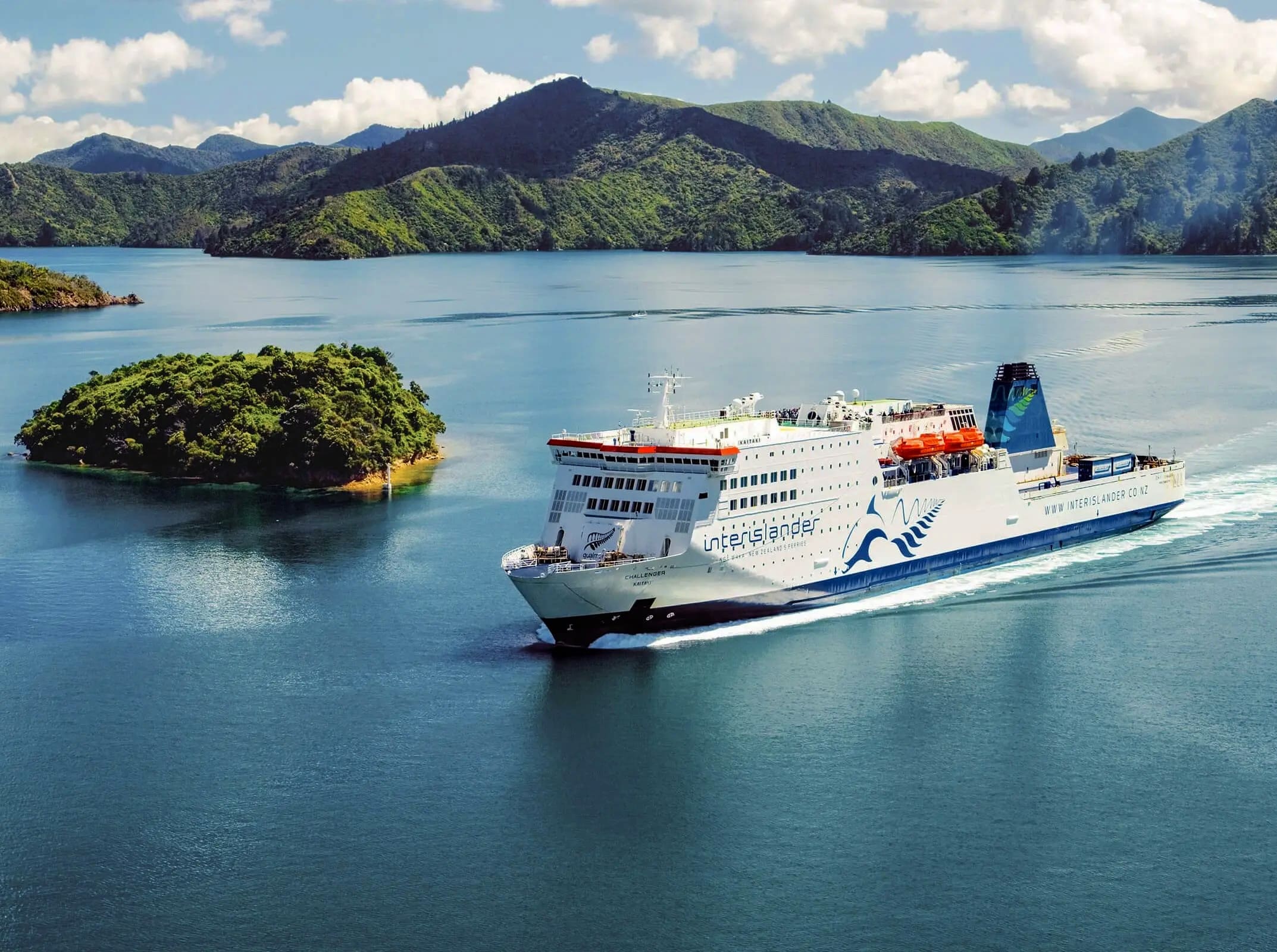
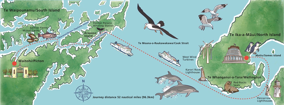
 The Cook Strait ferry is a meandering 93
kilometers (58 miles) and takes 3 1/ hours. 2/3's of that time
is a scenic spectacle, with the ferry looping around Wellington
Harbor and drifting through the fjord-like channels and inlets
of the Marlborough Sounds. The remaining 1/3 of the journey is
spend navigating Cook Strait between New Zealand's main
islands--a seafaring adventure through a dramatic and rugged
channel where the two seas met. Until the 1960's the ferries of
the now-defunct Union Steam Company ran directly from Wellington
to Christchurch
on the South Island. However, in 1962 KiwiRail integrated the ferry
The Cook Strait ferry is a meandering 93
kilometers (58 miles) and takes 3 1/ hours. 2/3's of that time
is a scenic spectacle, with the ferry looping around Wellington
Harbor and drifting through the fjord-like channels and inlets
of the Marlborough Sounds. The remaining 1/3 of the journey is
spend navigating Cook Strait between New Zealand's main
islands--a seafaring adventure through a dramatic and rugged
channel where the two seas met. Until the 1960's the ferries of
the now-defunct Union Steam Company ran directly from Wellington
to Christchurch
on the South Island. However, in 1962 KiwiRail integrated the ferry 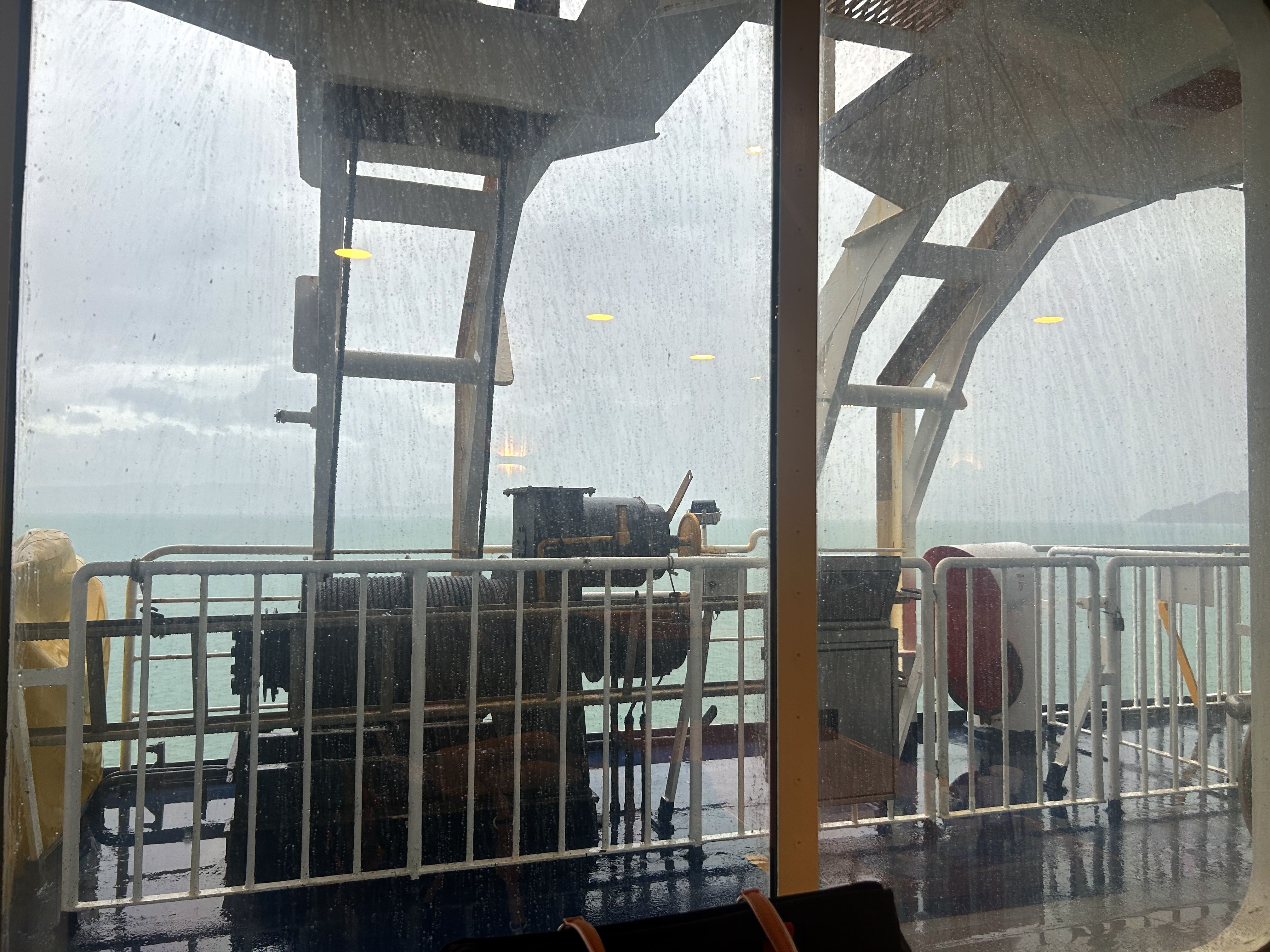
 service
into its routes, and used the Wellington to Picton ferry to
connect passengers from the Northern Explorer to its Coastal
Pacific route. The result was a much more tourist friendly
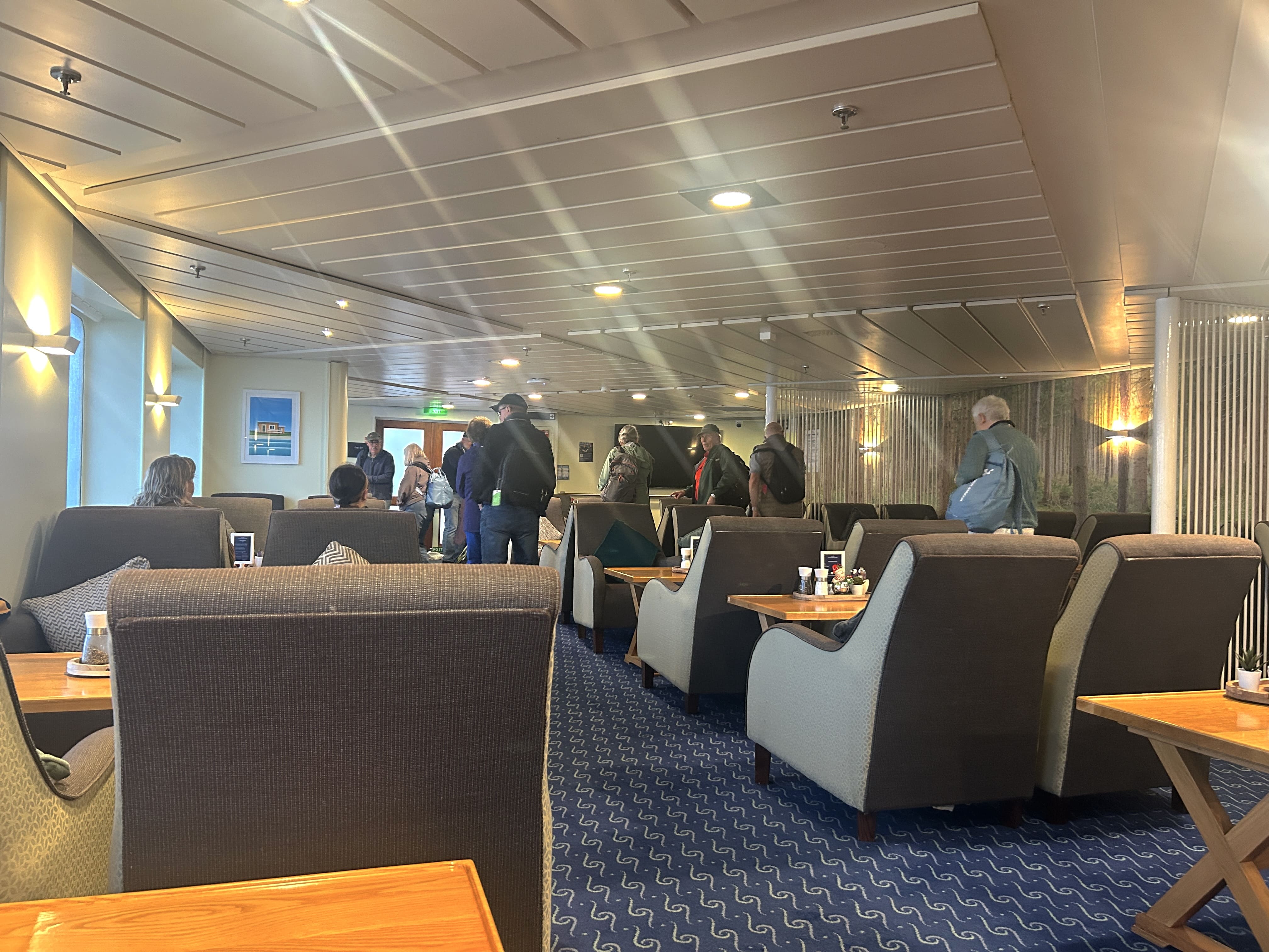
excursion between the two islands We boarded the ferry early in
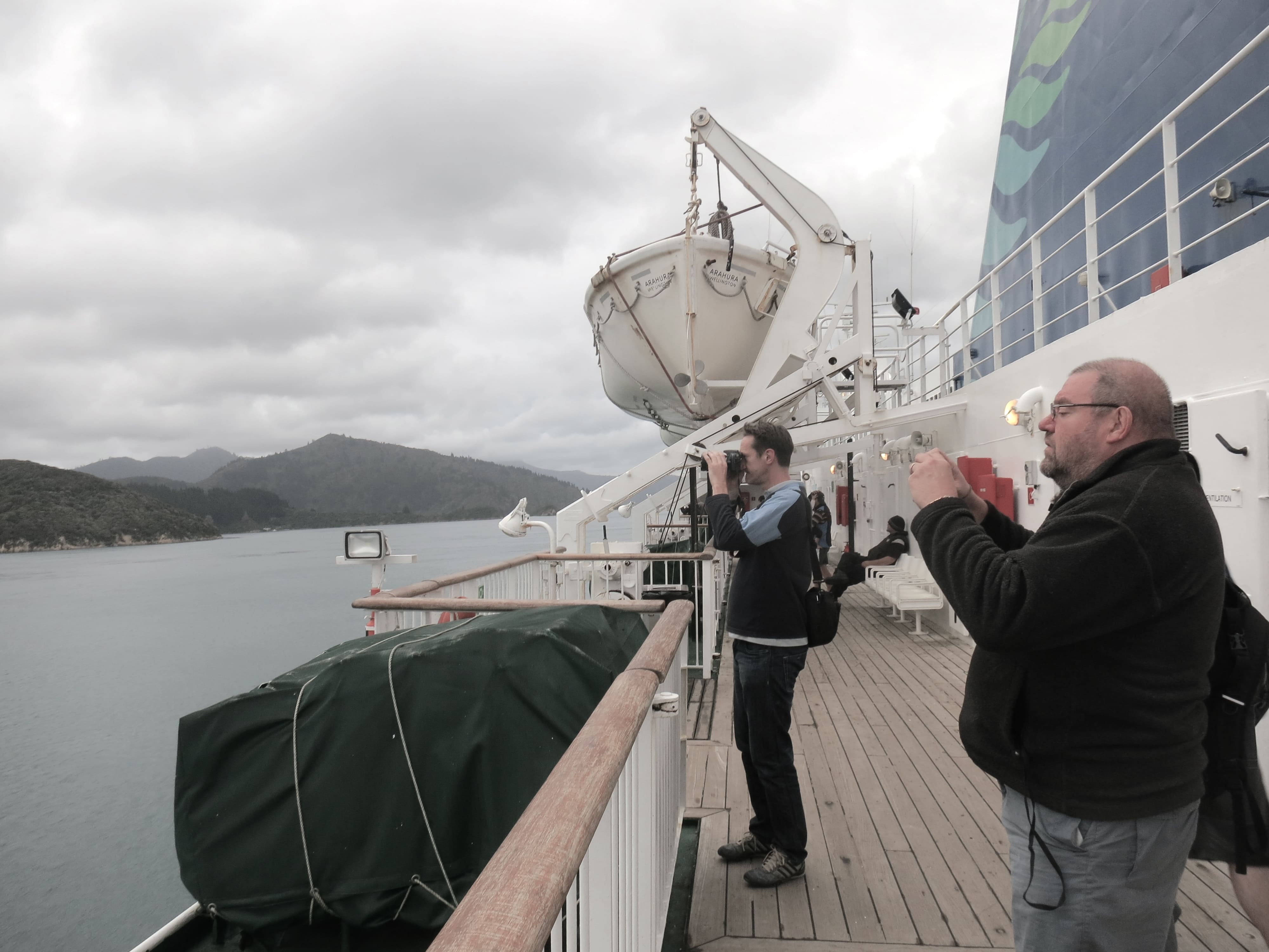
the morning and
the weather was windy and wet as the Interisland cast off her
lines and headed toward the Pencarrow Lighthouses. We spent most
the trip in the cold but sheltered premium lounge, taking tea
and breakfast. Below is a video by Great Journeys New Zealand
(our tour provider) that highlights some of the landmarks
visible on a clearer day. This landmarks may also be seen in the
photo gallery.
service
into its routes, and used the Wellington to Picton ferry to
connect passengers from the Northern Explorer to its Coastal
Pacific route. The result was a much more tourist friendly
excursion between the two islands We boarded the ferry early in
the morning and
the weather was windy and wet as the Interisland cast off her
lines and headed toward the Pencarrow Lighthouses. We spent most
the trip in the cold but sheltered premium lounge, taking tea
and breakfast. Below is a video by Great Journeys New Zealand
(our tour provider) that highlights some of the landmarks
visible on a clearer day. This landmarks may also be seen in the
photo gallery.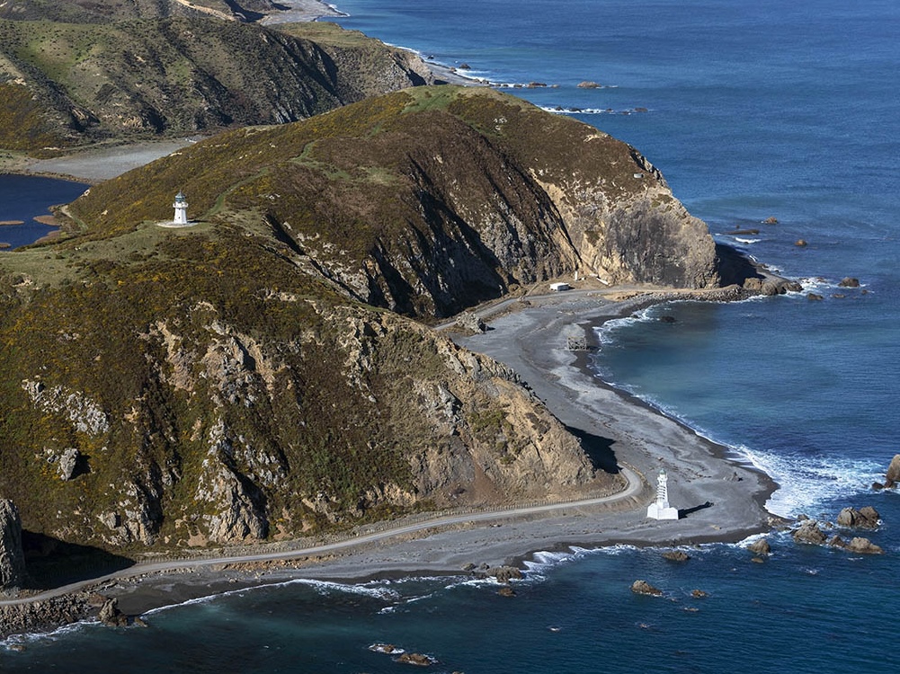 The ferry departs the scenic Wellington harbor,
nearly completely sheltered from the more rugged waters of the
Cook Strait, passing by the Pencarrow Lighthouses on the starboard
(or right side for you landlubbers) as you leave Wellington
Harbor. On top of the hill is New Zealand's first lighthouse.
Erected in 1858, Pencarrow Lighthouse was constructed in England
and shipped to New Zealand in 480 segments. The lighthouse was
run by the country's only female lighthouse keeper along with
her six children. The Lower Pencarrow Lighthouse was built on
the beach below in 1906 to be used during the frequent foggy
conditions that rendered the hilltop lighthouse useless.
The ferry departs the scenic Wellington harbor,
nearly completely sheltered from the more rugged waters of the
Cook Strait, passing by the Pencarrow Lighthouses on the starboard
(or right side for you landlubbers) as you leave Wellington
Harbor. On top of the hill is New Zealand's first lighthouse.
Erected in 1858, Pencarrow Lighthouse was constructed in England
and shipped to New Zealand in 480 segments. The lighthouse was
run by the country's only female lighthouse keeper along with
her six children. The Lower Pencarrow Lighthouse was built on
the beach below in 1906 to be used during the frequent foggy
conditions that rendered the hilltop lighthouse useless.| Pencarrow Lighthouses |
|
 |
 |
| Pencarrow
Upper Lighthouse |
Pencarrow
Lower Lighthouse |
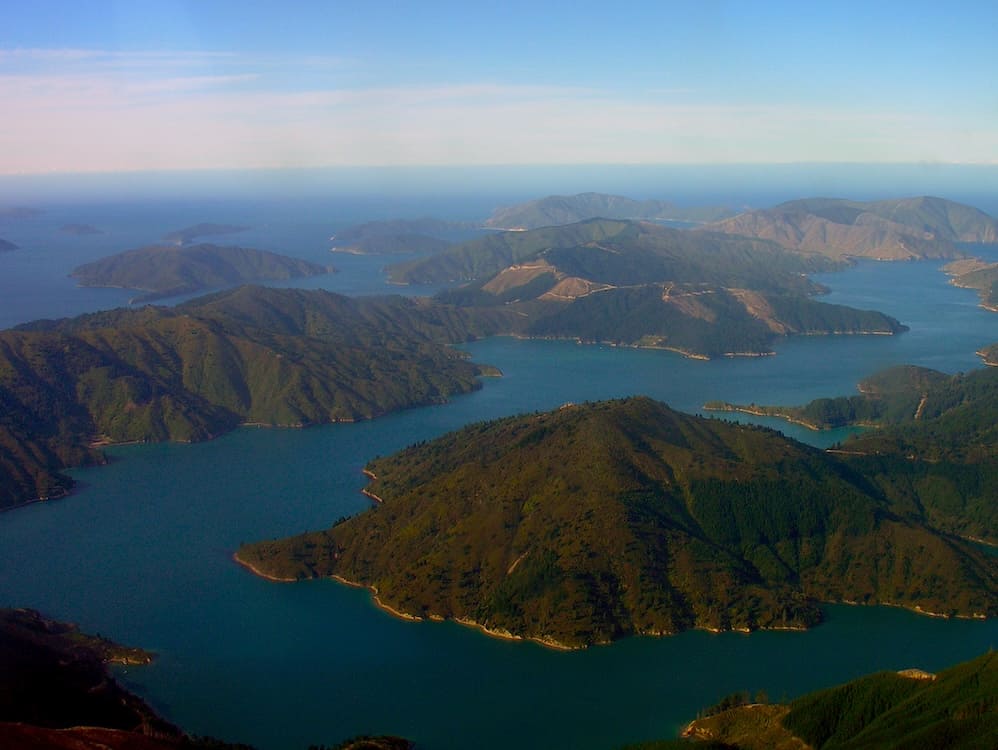 From the Cook Strait the Interisland
Ferry makes a dramatic swing to port (left) to enter the
narrow and protected Tory Sound. Given its rugged terrain,
the sound has often been compared to the fjords of
Scandinavia, and it is one of the most isolated regions in
New Zealand. The sparse settlements on the sound are only
able to be accessed by boat. One of the first
landmarks in the Tory Channel is Arapaoa Island, the second
largest in the channel.
From the Cook Strait the Interisland
Ferry makes a dramatic swing to port (left) to enter the
narrow and protected Tory Sound. Given its rugged terrain,
the sound has often been compared to the fjords of
Scandinavia, and it is one of the most isolated regions in
New Zealand. The sparse settlements on the sound are only
able to be accessed by boat. One of the first
landmarks in the Tory Channel is Arapaoa Island, the second
largest in the channel.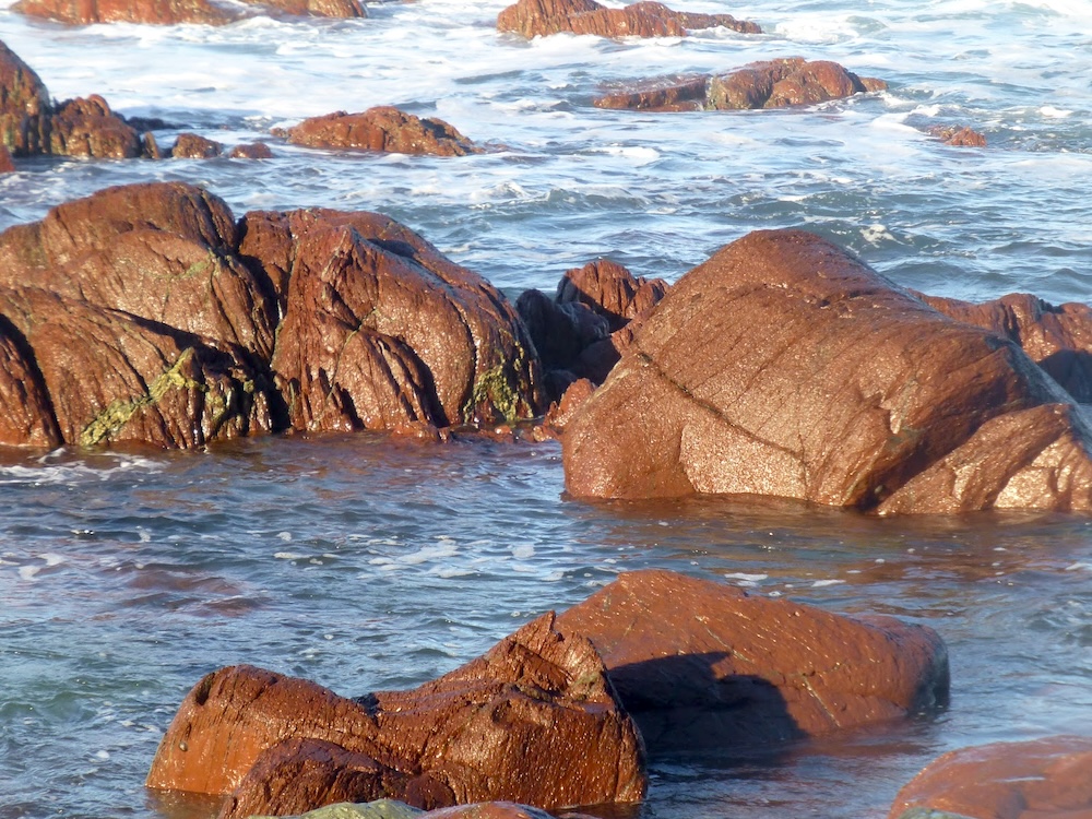
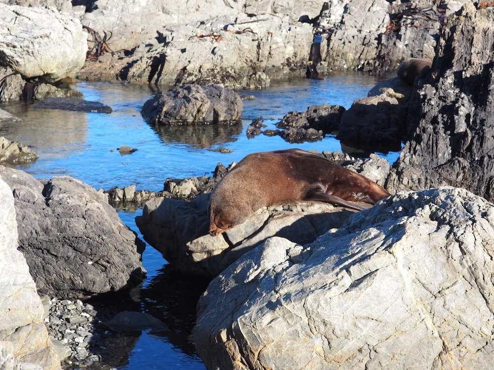 These
red colored rocks, visible from the starboard (right) side of
the ferry, are steeped in Maori history. Formed over 200 years
ago, Maori folklore tells two tales of the origin of the rocks.
In one version, Kupe--the famous Polynesia explorer--was
gathering shellfish when one clamped his hand. Kupe bled and
stained the rocks red. In the other tale red is the blood of
Kupe's daughters. Fearing for their father's safety on a long
voyage, they gashed themselves in grief over his absence. In
addition to being spotted from the ferry on clear days, there is
also a trail from Owhiro Bay that leads to the location. During
the winter months a colony of seals may be found nesting there.
These
red colored rocks, visible from the starboard (right) side of
the ferry, are steeped in Maori history. Formed over 200 years
ago, Maori folklore tells two tales of the origin of the rocks.
In one version, Kupe--the famous Polynesia explorer--was
gathering shellfish when one clamped his hand. Kupe bled and
stained the rocks red. In the other tale red is the blood of
Kupe's daughters. Fearing for their father's safety on a long
voyage, they gashed themselves in grief over his absence. In
addition to being spotted from the ferry on clear days, there is
also a trail from Owhiro Bay that leads to the location. During
the winter months a colony of seals may be found nesting there.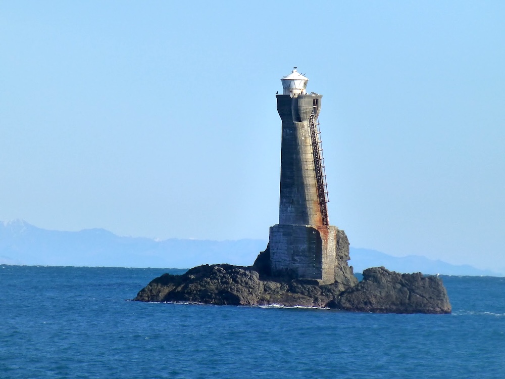 Winding
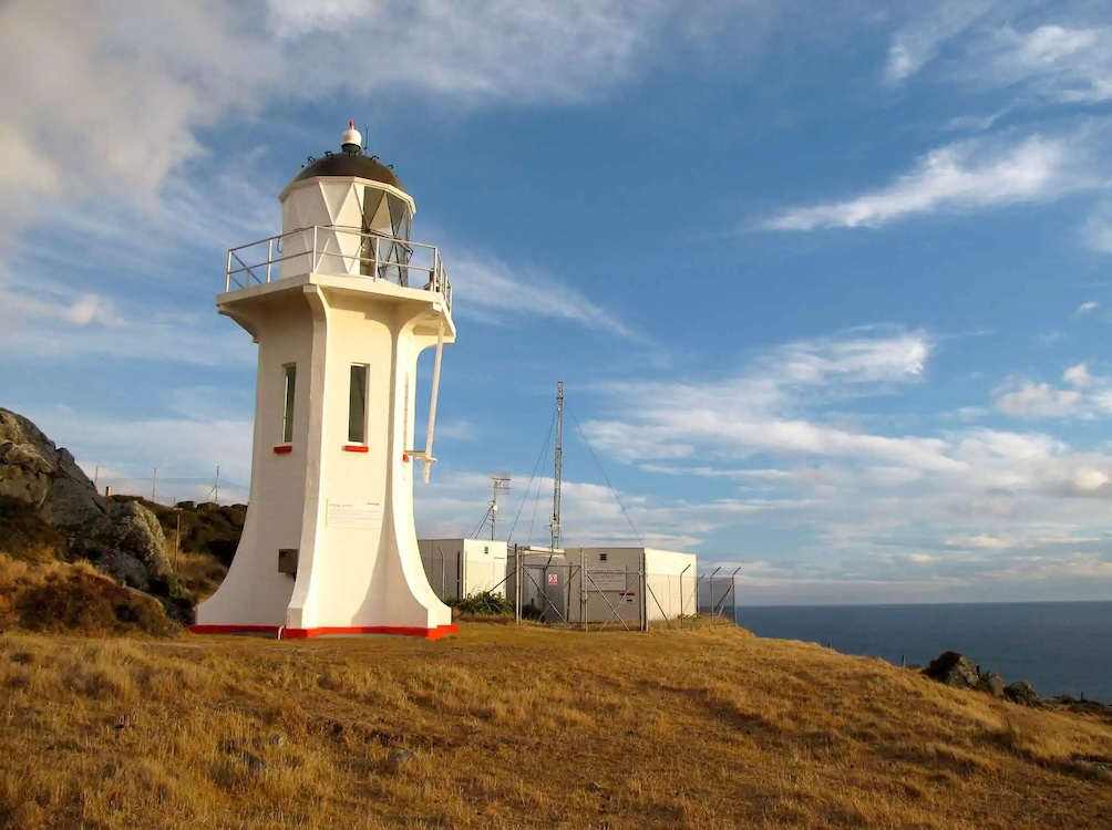
around the tip of the North Island the ferry passes by the
Karori Lighthouse, perched on a rocky stone perch just offshore.
A unique feature of the lighthouse is that it is tilted. Because
of this, it is often referred to as the "Leaning Lighthouse." It
was designed this way to make it easier for the lighthouse
keeper to climb the ladder to the beacon. Built in 1915, it
stands 20 meters above sea level and was designed to withstand
the fierce winds of Cook Strait. It served its purpose for
eighty years and was decommissioned in May 1996, replaced by a
flashing beacon on the mainland at Tongue Point.
Winding
around the tip of the North Island the ferry passes by the
Karori Lighthouse, perched on a rocky stone perch just offshore.
A unique feature of the lighthouse is that it is tilted. Because
of this, it is often referred to as the "Leaning Lighthouse." It
was designed this way to make it easier for the lighthouse
keeper to climb the ladder to the beacon. Built in 1915, it
stands 20 meters above sea level and was designed to withstand
the fierce winds of Cook Strait. It served its purpose for
eighty years and was decommissioned in May 1996, replaced by a
flashing beacon on the mainland at Tongue Point.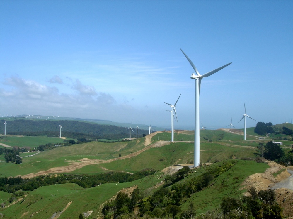 Winding
around the west end of the North Island and heading into the
Cook Strait, the West Wind Farm comes into view. Completed
in 2009, it boasts 62 towering windmills. It
was built in this location to take advantage of the strong "wind
tunnel" effect of the Cook Strait, which provides steady and
reliable breezes. The power the windmills generate power for
about 73,00 homes each year.
Winding
around the west end of the North Island and heading into the
Cook Strait, the West Wind Farm comes into view. Completed
in 2009, it boasts 62 towering windmills. It
was built in this location to take advantage of the strong "wind
tunnel" effect of the Cook Strait, which provides steady and
reliable breezes. The power the windmills generate power for
about 73,00 homes each year.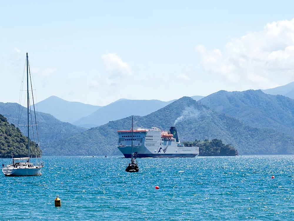
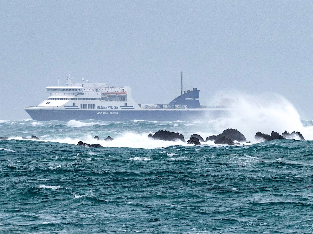 Cook
Strait is the rugged channel between New Zealand's North and South
Islands where the Tasman Sea and the Pacific Ocean meet. It is one
of the most violent and unpredictable stretches of water in the
world. At 45 degrees south of the
equator, the Cook Strait lies firmly in what sailors call the
"Roaring Forties" a region between 40 and 50 degrees south,
where the winds circle the earthly unimpeded by any major land
mass. There is an annual swim event to cross this roughly 22
kilometers (14 miles) of open sea. Swimmers who succeed are
rewarded with a lifetime pass on the ferries operating between
the two islands. The photo to the left shows the ferry
traversing the strait when the waters were calm, while the photo
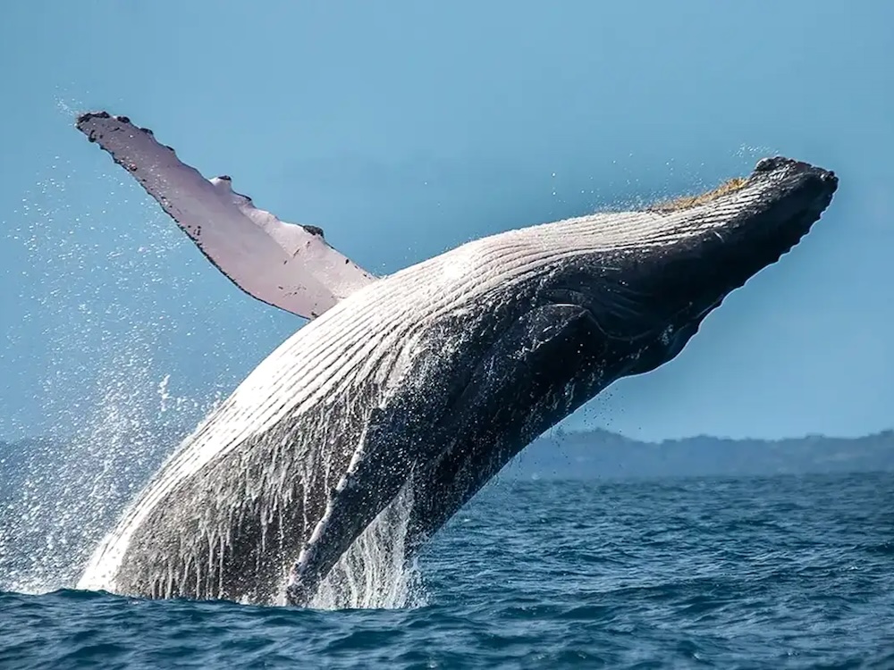
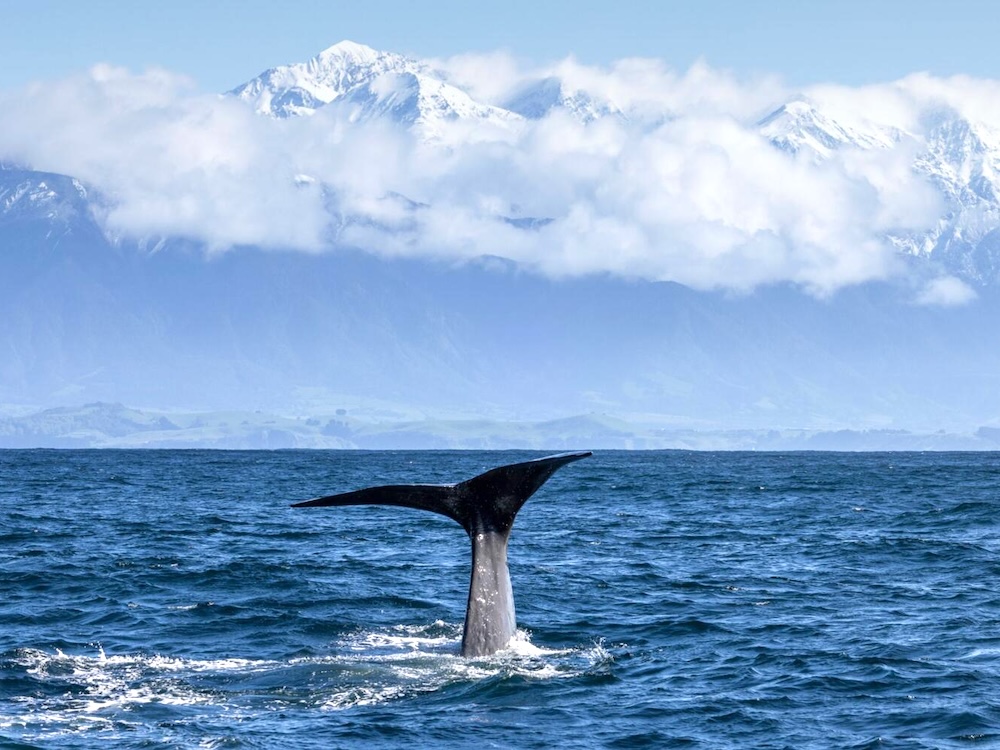
to the right shows a ferry during a turbulent crossing. During the winter months, humpback
whales can be seen migrating through the channels, which was why
whaling was such a big business until the 1960's. Unfortunately for us the weather
reduced visability, and we were not sailing during the peak
season for whale watching.
Cook
Strait is the rugged channel between New Zealand's North and South
Islands where the Tasman Sea and the Pacific Ocean meet. It is one
of the most violent and unpredictable stretches of water in the
world. At 45 degrees south of the
equator, the Cook Strait lies firmly in what sailors call the
"Roaring Forties" a region between 40 and 50 degrees south,
where the winds circle the earthly unimpeded by any major land
mass. There is an annual swim event to cross this roughly 22
kilometers (14 miles) of open sea. Swimmers who succeed are
rewarded with a lifetime pass on the ferries operating between
the two islands. The photo to the left shows the ferry
traversing the strait when the waters were calm, while the photo
to the right shows a ferry during a turbulent crossing. During the winter months, humpback
whales can be seen migrating through the channels, which was why
whaling was such a big business until the 1960's. Unfortunately for us the weather
reduced visability, and we were not sailing during the peak
season for whale watching.| Whale Watching in
the Cook Strait (click on photo to enlarge) |
|
 |
 |
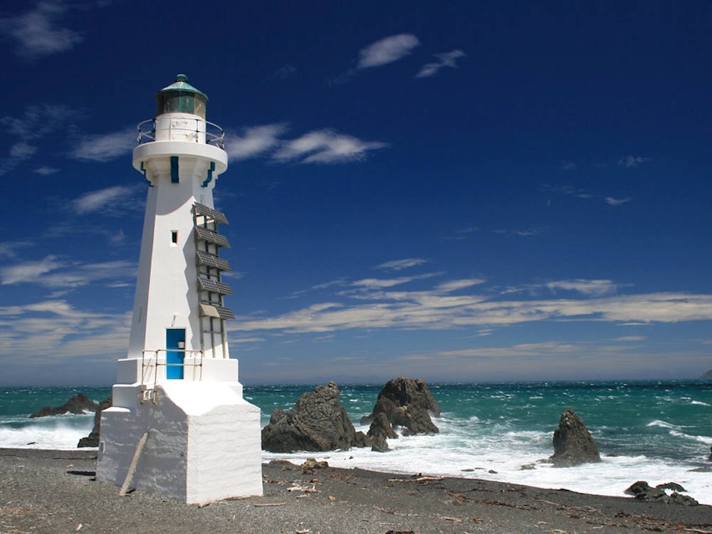
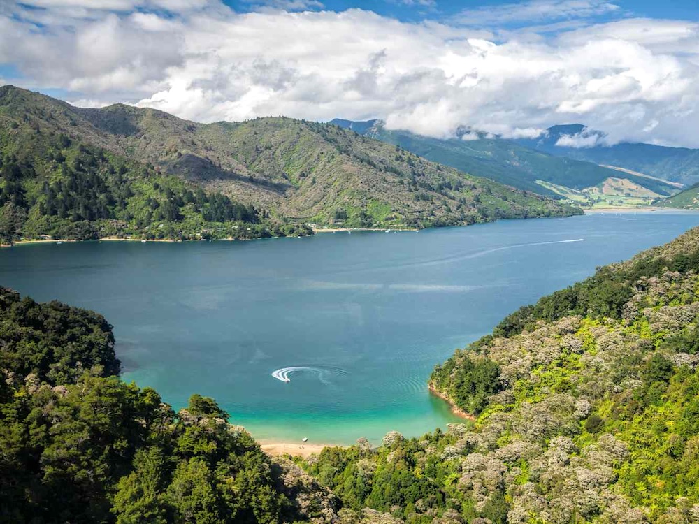
 Leaving the Cook Strait, the Interisland
Ferry makes an abrupt turn to port (left) and enters a narrow
protected channel that is reminiscent of the fjords of
Scandinavia. This is a very remote and beautiful setting, and to
either side of the water are the Marlborough hills. Much of this
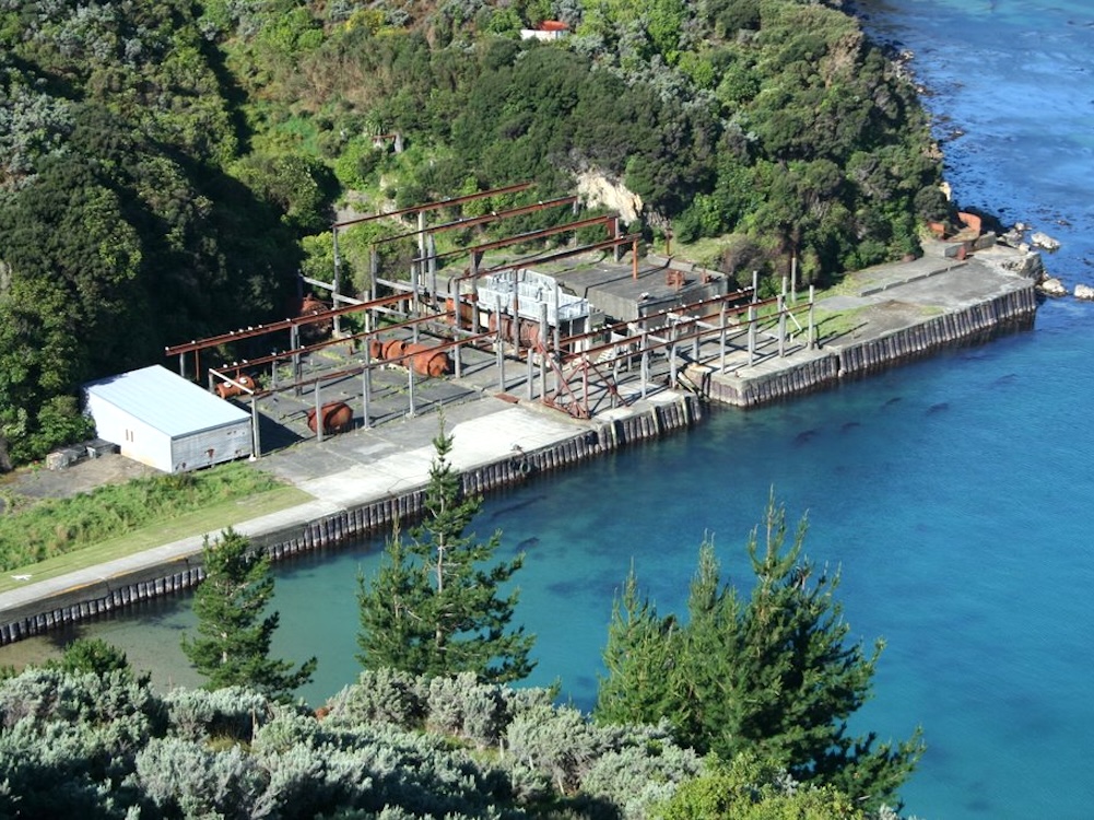
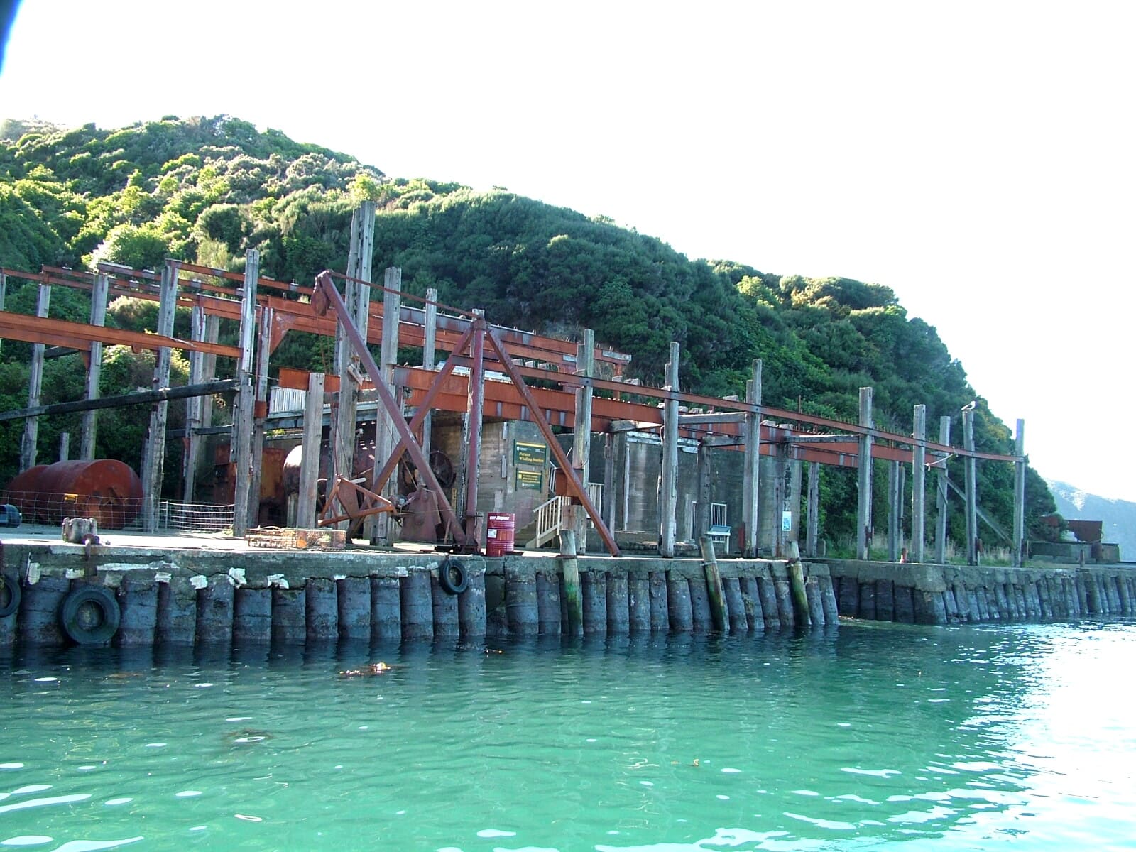
scenery may only be accessed by water. The first landmark
visible from the deck of the ferry is the former Perano Whaling
Center. As you can see from the photos, all that remains are
skeletal forms of the original buildings. The whaling station
was established in 1923 as a small village consisting of whalers
and their families. They hunted humpback whales on their annual
migration through the Cook Strait; more than 3,000 whales were
hauled ashore here to be processed for baleen (whale bone) and
whale oil. Whaling continued until 1964, although whales were
not fully
Leaving the Cook Strait, the Interisland
Ferry makes an abrupt turn to port (left) and enters a narrow
protected channel that is reminiscent of the fjords of
Scandinavia. This is a very remote and beautiful setting, and to
either side of the water are the Marlborough hills. Much of this
scenery may only be accessed by water. The first landmark
visible from the deck of the ferry is the former Perano Whaling
Center. As you can see from the photos, all that remains are
skeletal forms of the original buildings. The whaling station
was established in 1923 as a small village consisting of whalers
and their families. They hunted humpback whales on their annual
migration through the Cook Strait; more than 3,000 whales were
hauled ashore here to be processed for baleen (whale bone) and
whale oil. Whaling continued until 1964, although whales were
not fully 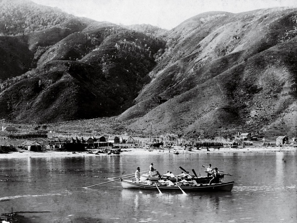 protected
in the region until 1978. As with most bans, whaling ended
largely because
protected
in the region until 1978. As with most bans, whaling ended
largely because 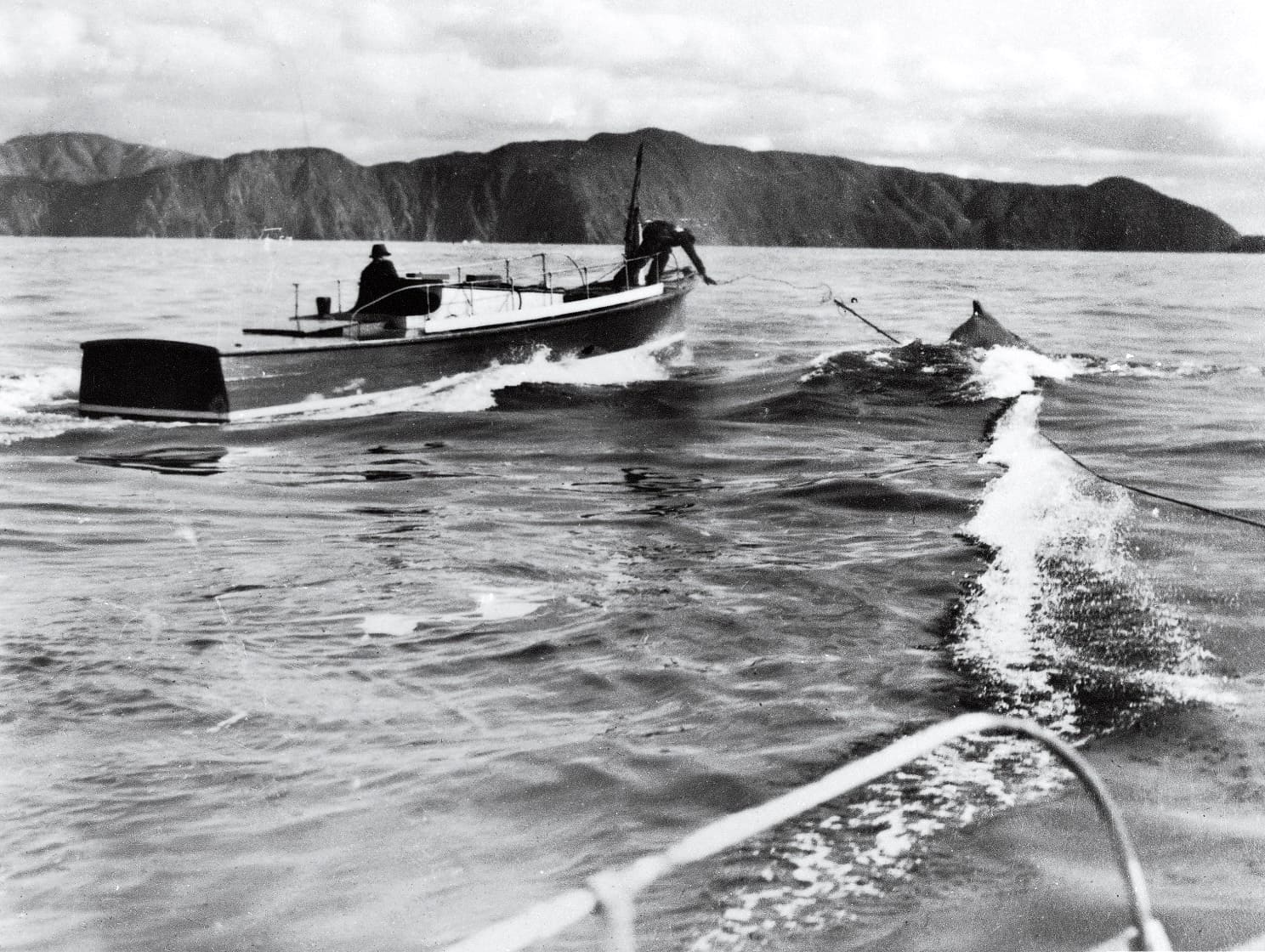 it was economically unfeasible. There were fewer whales
migrating through the Cook Strait and the availability of
alternate raw material essentially doomed the industry. The
remaining building is now used for conservation, supporting the
counting and tagging of Humpback whales as their numbers slowly
rebuild. The bottom photos show how the station looked
when in operation.
it was economically unfeasible. There were fewer whales
migrating through the Cook Strait and the availability of
alternate raw material essentially doomed the industry. The
remaining building is now used for conservation, supporting the
counting and tagging of Humpback whales as their numbers slowly
rebuild. The bottom photos show how the station looked
when in operation.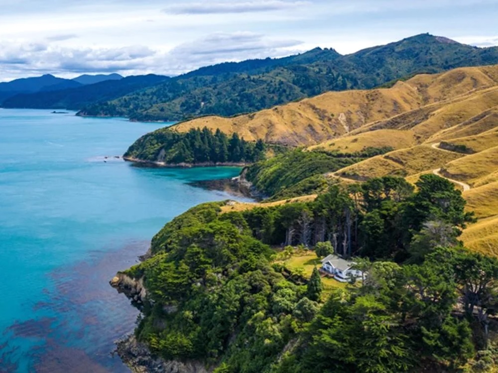 |
 |
 |
| Arapaoa Island |
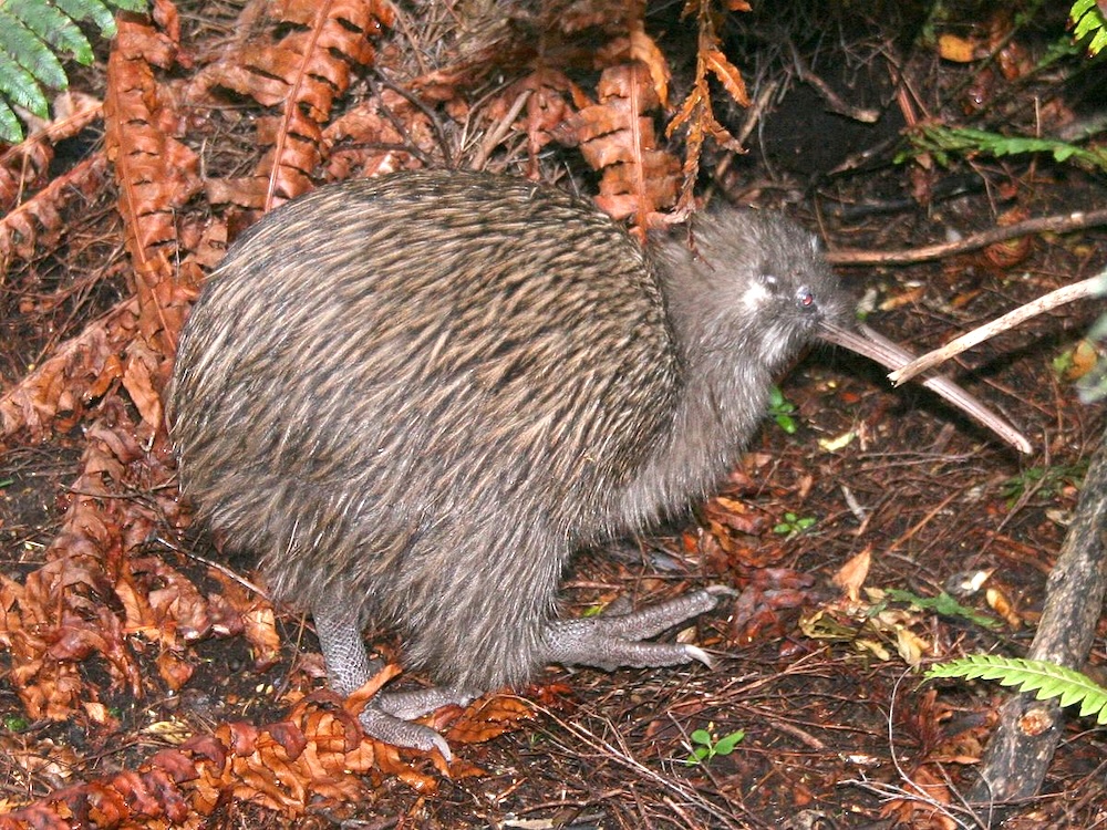
The Endangered Kiwi |
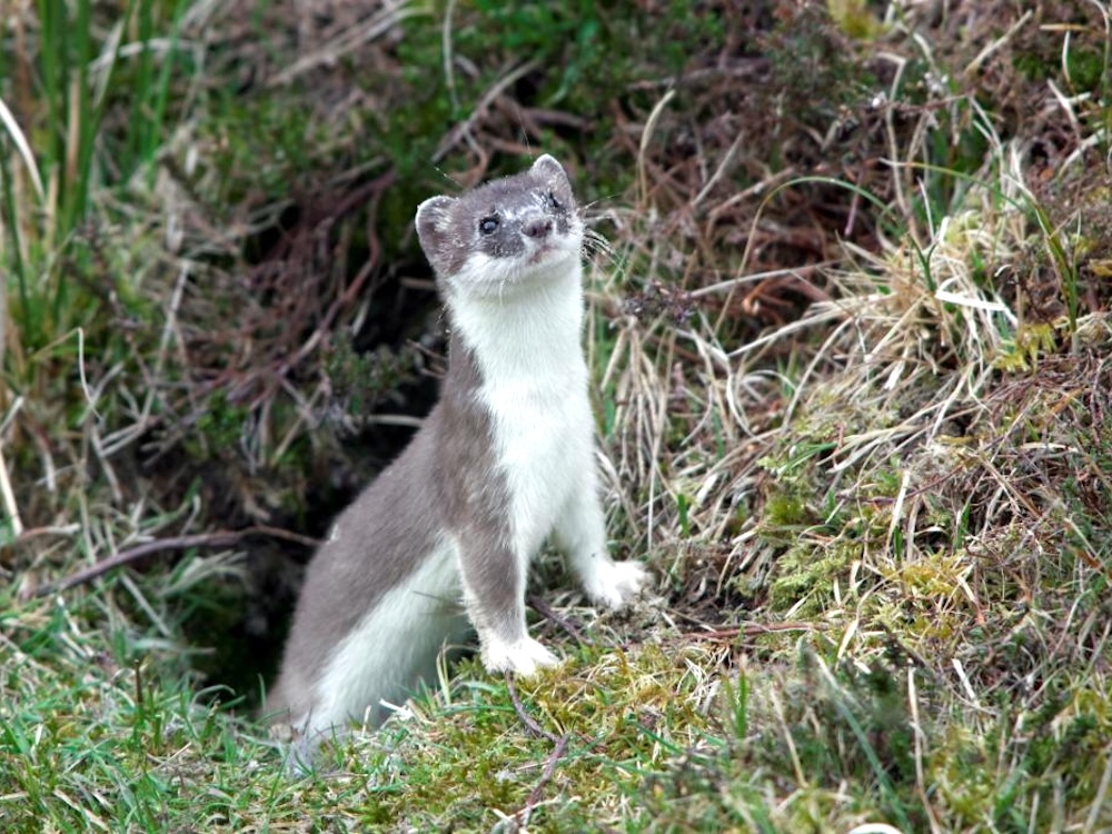
The Predatory Stoat |
 The Tory Channel
merges with Queen Charlotte Sound at about the latter's
mid-point. It begins at the north part of the island and the
Tasman Sea, and follows a path that parallels the Tory Channel,
albeit on the other side of the mountains. Compared to Cook
Strait and the Tasman Sea, Queen Charlotte Sound is calm, and
was Captain Cook's favored port of call on his three voyages, a
place to take on supplies and repair his ships. (for anyone
interested in the voyages of Captain Cook, we recommend The Wide Wide Sea by Hampton Sides)
The Tory Channel
merges with Queen Charlotte Sound at about the latter's
mid-point. It begins at the north part of the island and the
Tasman Sea, and follows a path that parallels the Tory Channel,
albeit on the other side of the mountains. Compared to Cook
Strait and the Tasman Sea, Queen Charlotte Sound is calm, and
was Captain Cook's favored port of call on his three voyages, a
place to take on supplies and repair his ships. (for anyone
interested in the voyages of Captain Cook, we recommend The Wide Wide Sea by Hampton Sides)
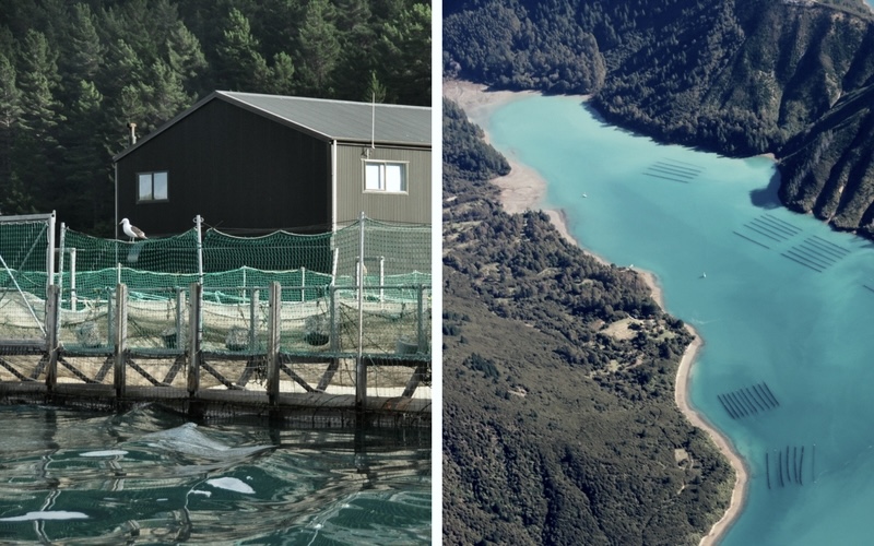
 By entering the Queen Charlotte Sound, the
Interisland Ferry is on the last leg of this 96 km (60 miles)
journey. In addition to the unspoiled splendor of this remote
landscape, two landmarks are visible from the ferry, and they
underscore the maritime riches of this area. The first are the
salmon farms. King salmon have been farmed here for more than 25
years, as they thrive in the sound's cool, clear waters. Salmon
are hatched in fresh water and then transferred to the large sea
pens that line Queen Charlotte Sound. When fully grown, the fish
are harvested and then sent to Nelson (due west of Picton on
Tasman Bay) for processing. The photo to the left shows a salmon
fishery and the pens that dot the coastline. The photo to
the right offers a closer view of the pens
By entering the Queen Charlotte Sound, the
Interisland Ferry is on the last leg of this 96 km (60 miles)
journey. In addition to the unspoiled splendor of this remote
landscape, two landmarks are visible from the ferry, and they
underscore the maritime riches of this area. The first are the
salmon farms. King salmon have been farmed here for more than 25
years, as they thrive in the sound's cool, clear waters. Salmon
are hatched in fresh water and then transferred to the large sea
pens that line Queen Charlotte Sound. When fully grown, the fish
are harvested and then sent to Nelson (due west of Picton on
Tasman Bay) for processing. The photo to the left shows a salmon
fishery and the pens that dot the coastline. The photo to
the right offers a closer view of the pens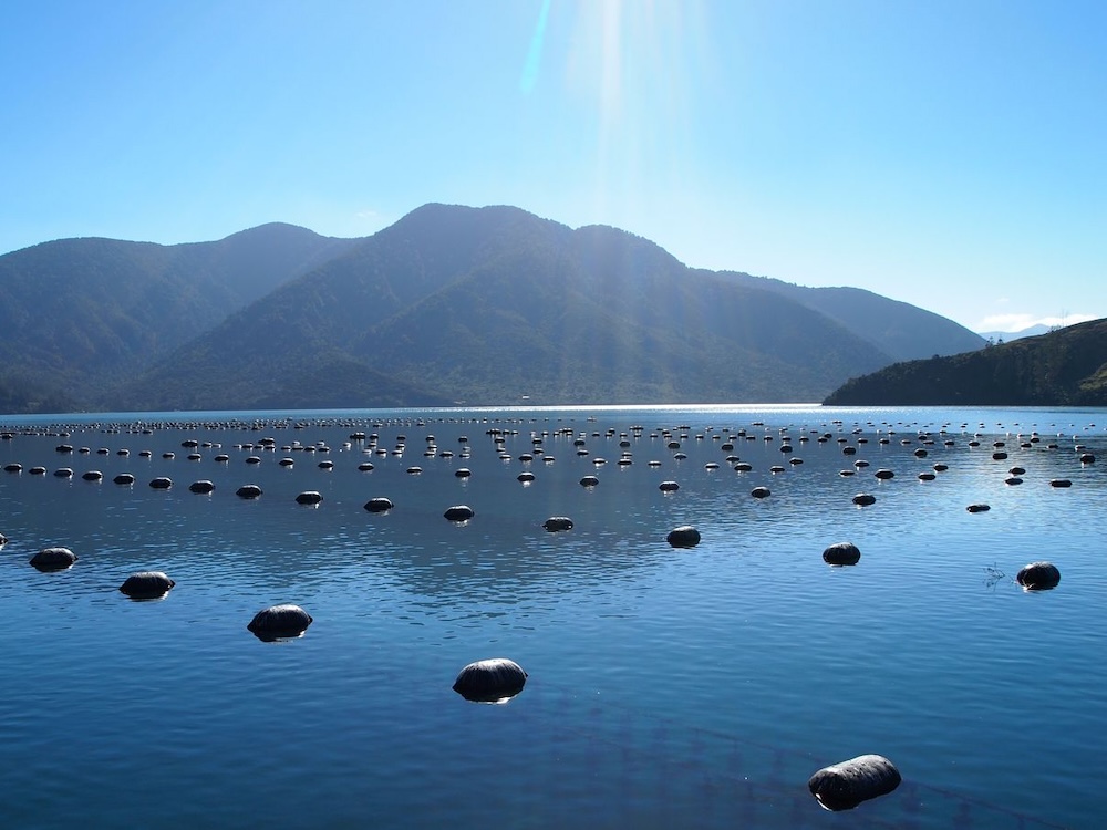
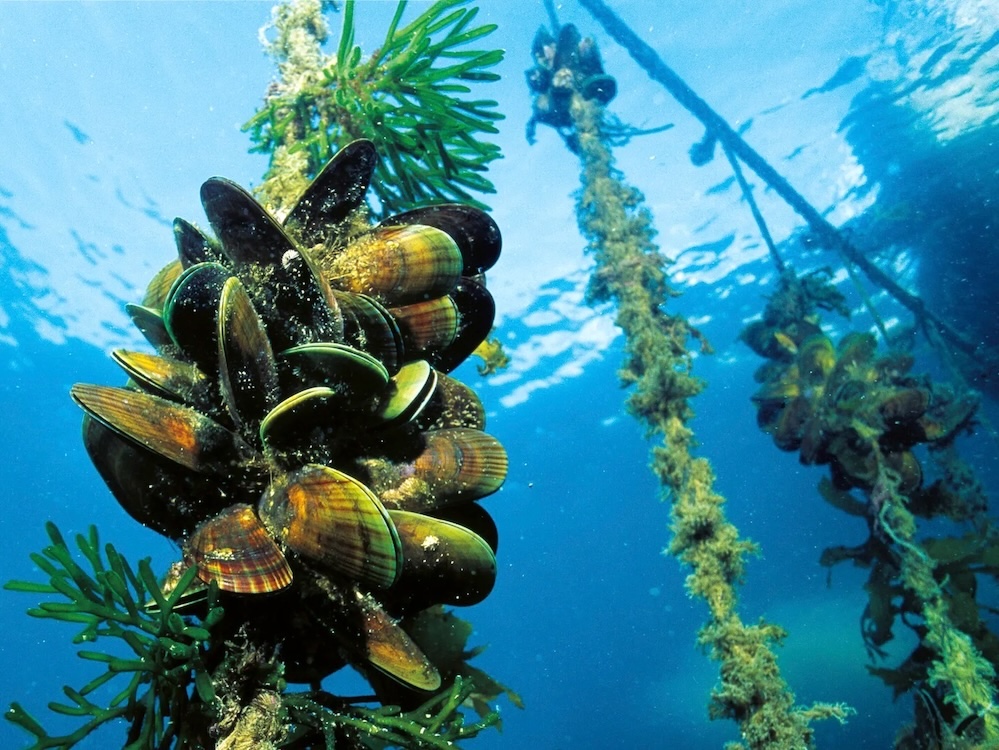 The second landmark spotted
from the ferry is also tied to the maritime industry, this
time in the form of mussel farms. They are identifiable by the
clusters of large oval buoys (photo to the left). They are the
only sign of the substantial mussel population dwelling
beneath the tranquil surface. Since the 1970's the sound has
been considered an ideal location for farming green-lipped
mussels. Mussels growing on lines below the surface and
attached to the buoys above are visible in the photo to the
left
The second landmark spotted
from the ferry is also tied to the maritime industry, this
time in the form of mussel farms. They are identifiable by the
clusters of large oval buoys (photo to the left). They are the
only sign of the substantial mussel population dwelling
beneath the tranquil surface. Since the 1970's the sound has
been considered an ideal location for farming green-lipped
mussels. Mussels growing on lines below the surface and
attached to the buoys above are visible in the photo to the
left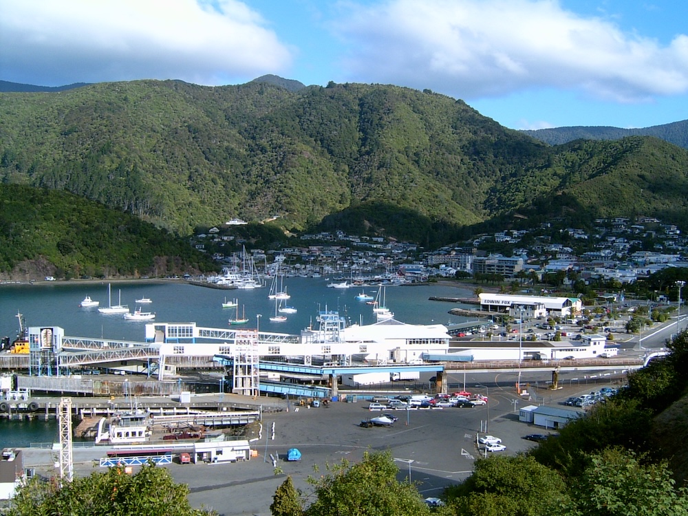 Continuing
down the Queen Charlotte Sound, the ferry reaches its port of
call, Picton. It is a quiet place, a small town built around the
ferry trade. It is also the jumping off place to holiday spots
on the Queen Charlotte Sound. For Great Journey New Zealand
passengers, it is the gateway to the Marlborough wineries.
Continuing
down the Queen Charlotte Sound, the ferry reaches its port of
call, Picton. It is a quiet place, a small town built around the
ferry trade. It is also the jumping off place to holiday spots
on the Queen Charlotte Sound. For Great Journey New Zealand
passengers, it is the gateway to the Marlborough wineries.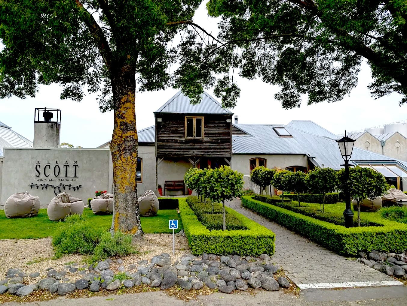
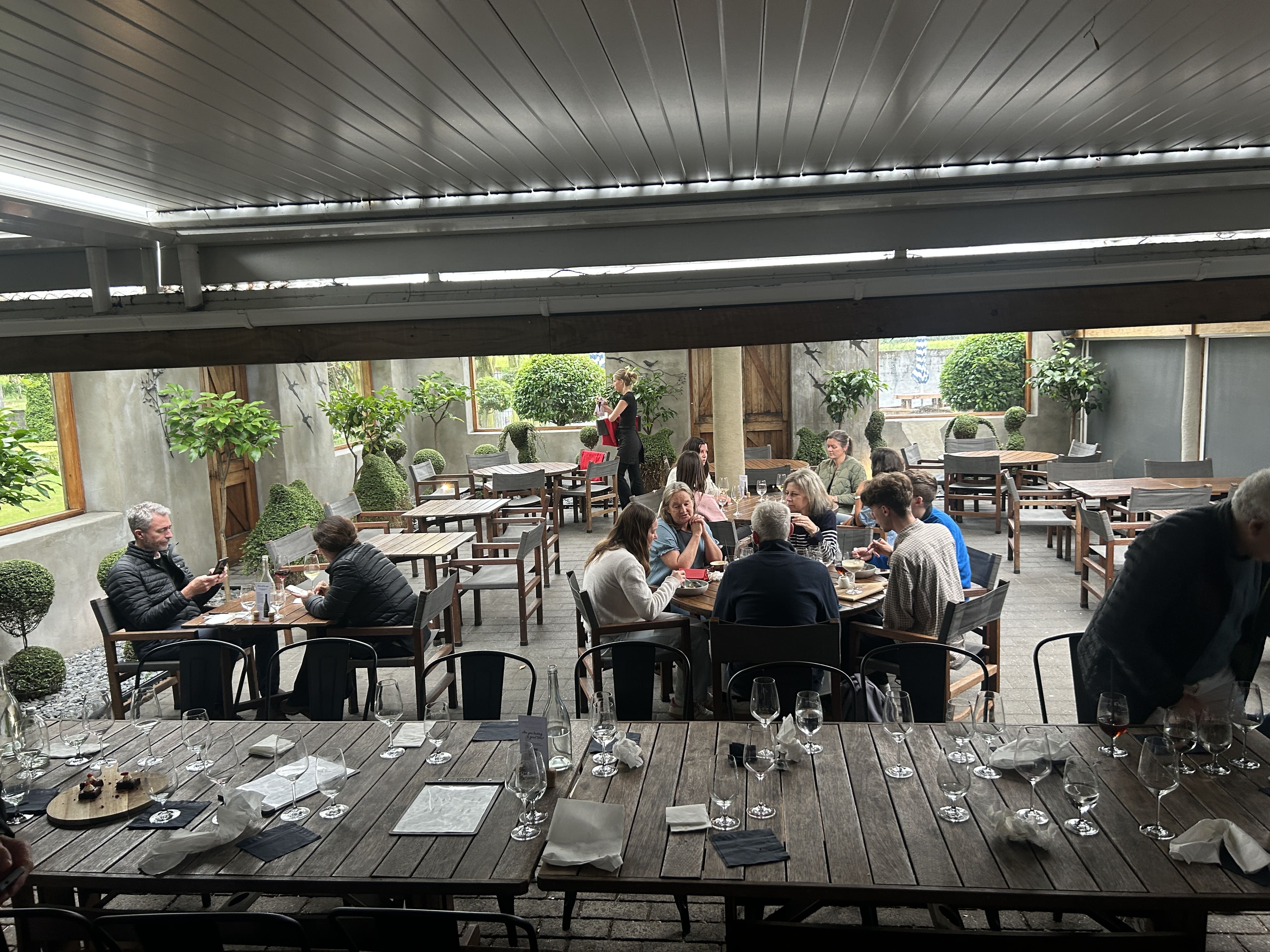
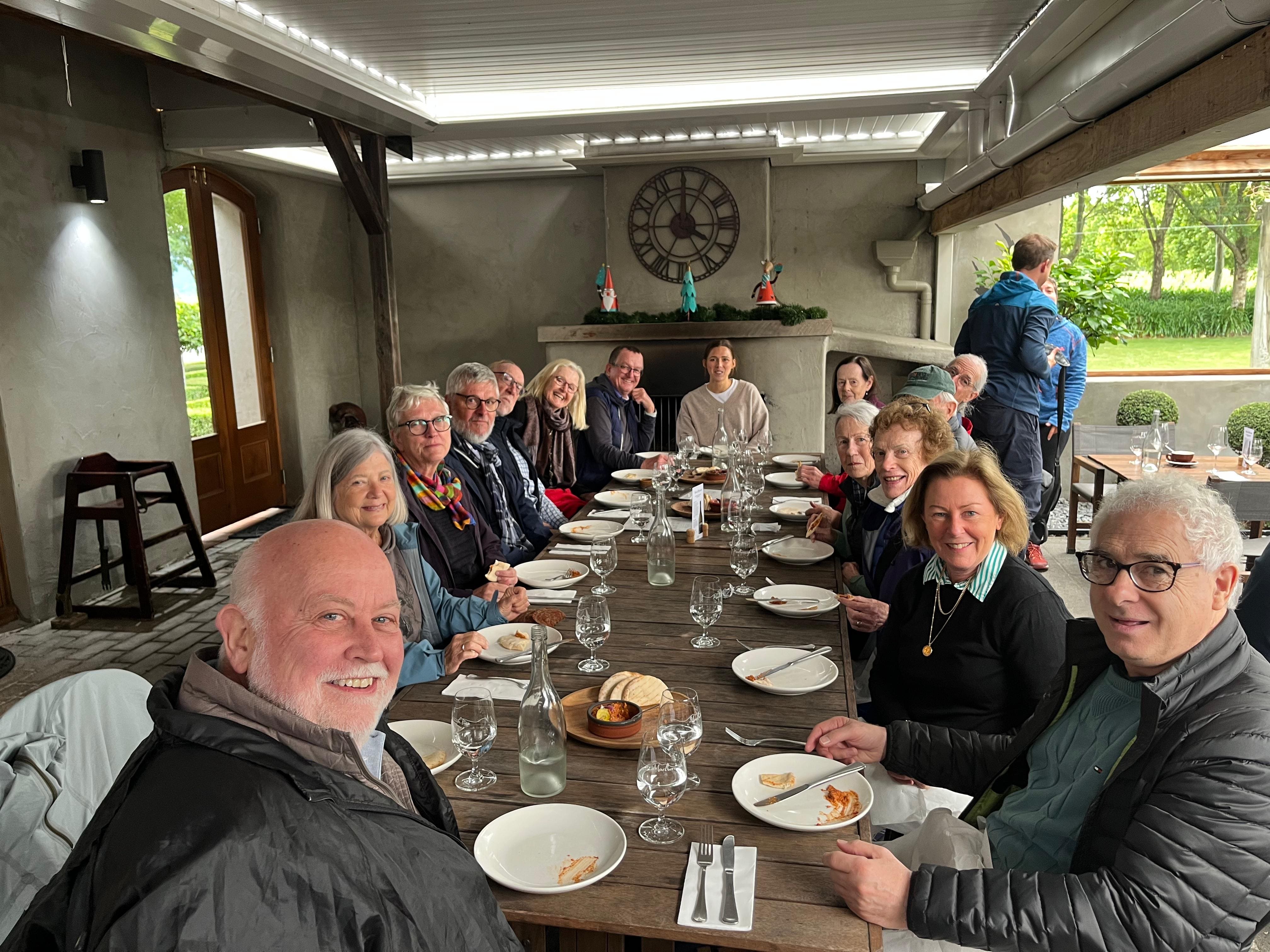
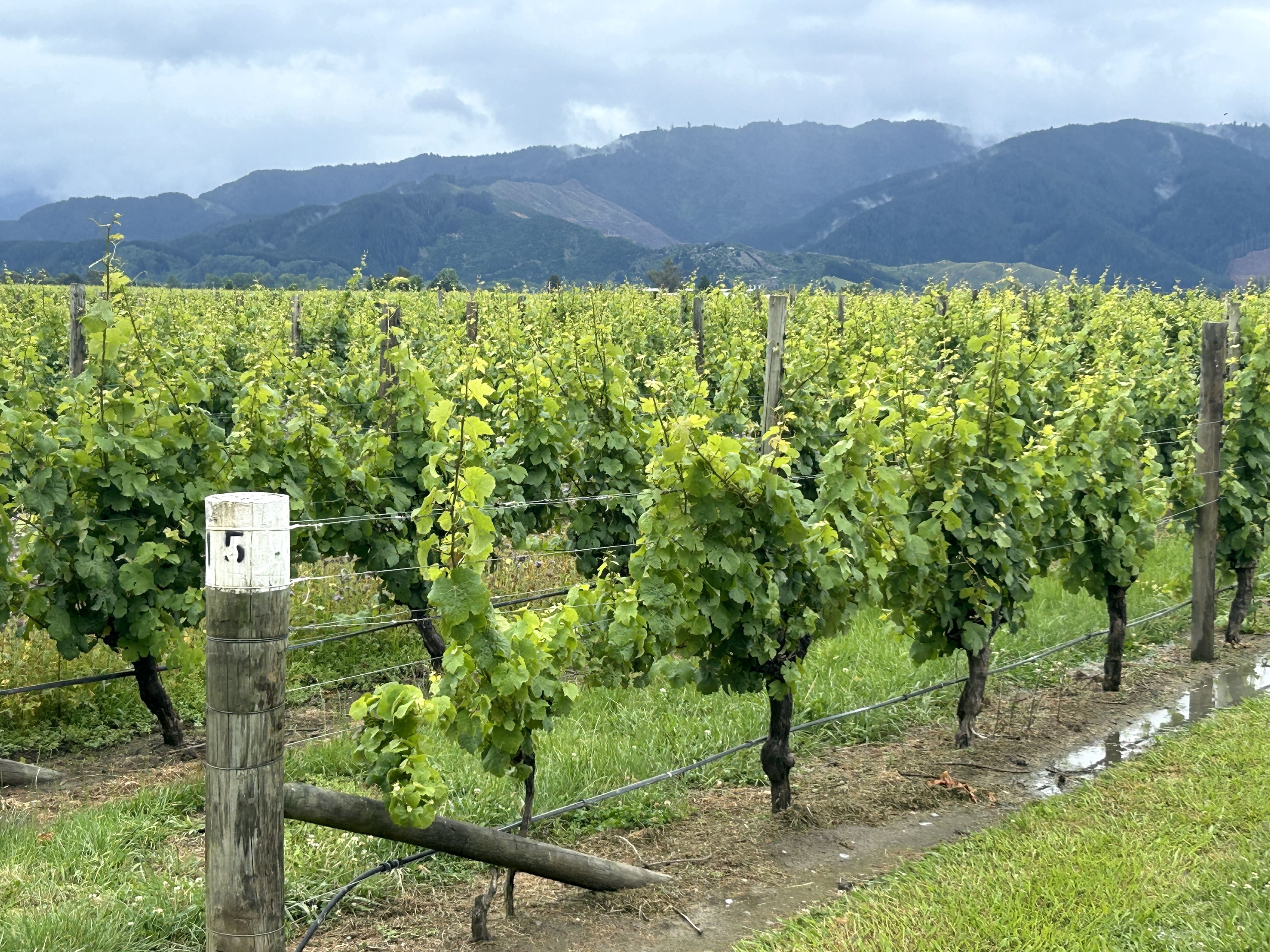 Day Eight
was devoted to epicurean delights, indulging in a
Marlborough wine tour. We began the tour at Allan Scott
Winery, where we sampled three of their wines and then
paired our choice with a big lunch, in this case pork belly
with salad and orzo. Fully sated, we continued our South
Island bacchanalia by going to, yes, another Malborough
winery. Below is a promotional video made by
the vinter.
Day Eight
was devoted to epicurean delights, indulging in a
Marlborough wine tour. We began the tour at Allan Scott
Winery, where we sampled three of their wines and then
paired our choice with a big lunch, in this case pork belly
with salad and orzo. Fully sated, we continued our South
Island bacchanalia by going to, yes, another Malborough
winery. Below is a promotional video made by
the vinter.| Allan Scott
Winery (click on image to enlarge) |
||
 |
 |
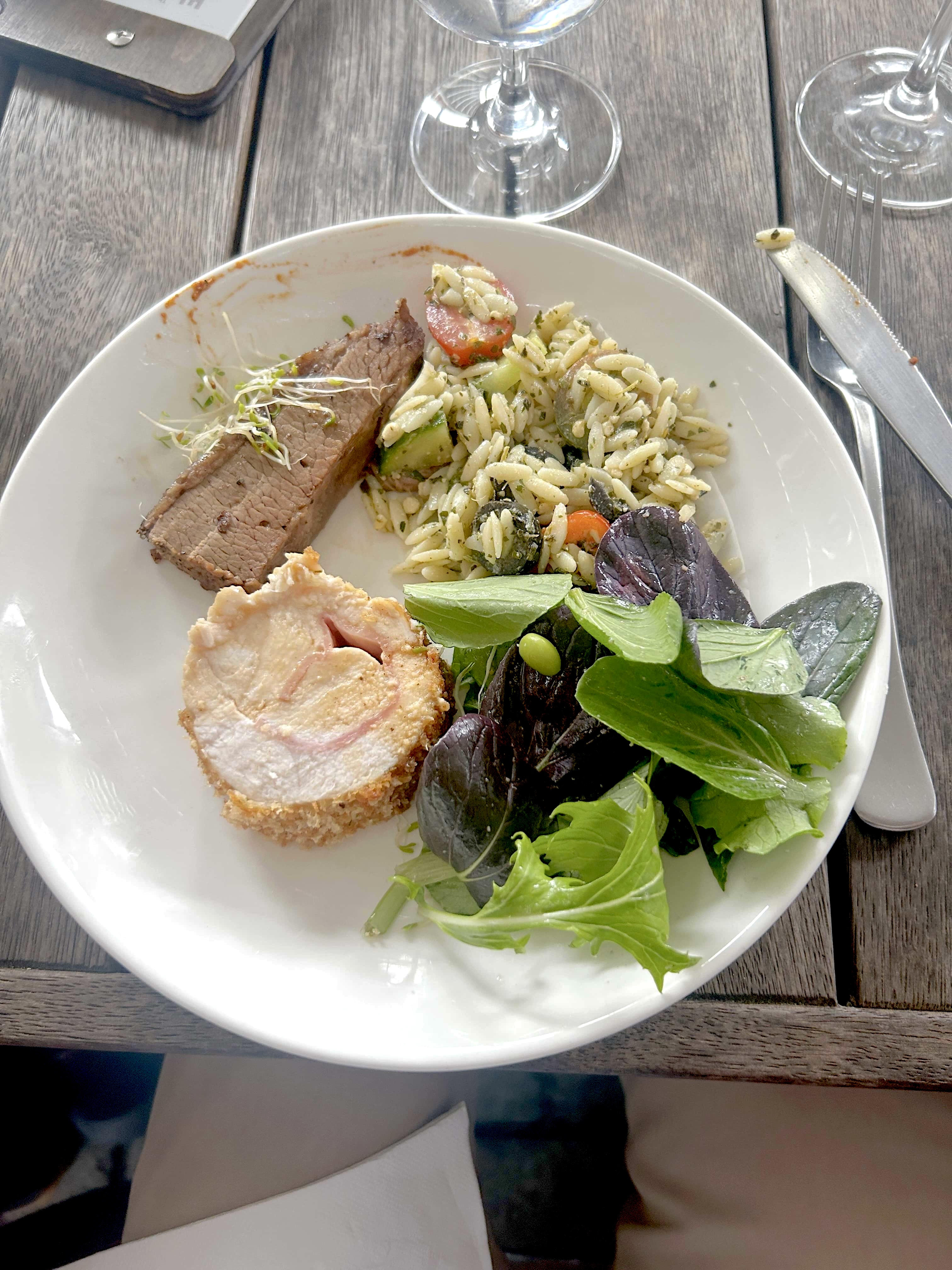 |
| Wine Tasting |
Group Meal |
Pork Belly & Orzo |
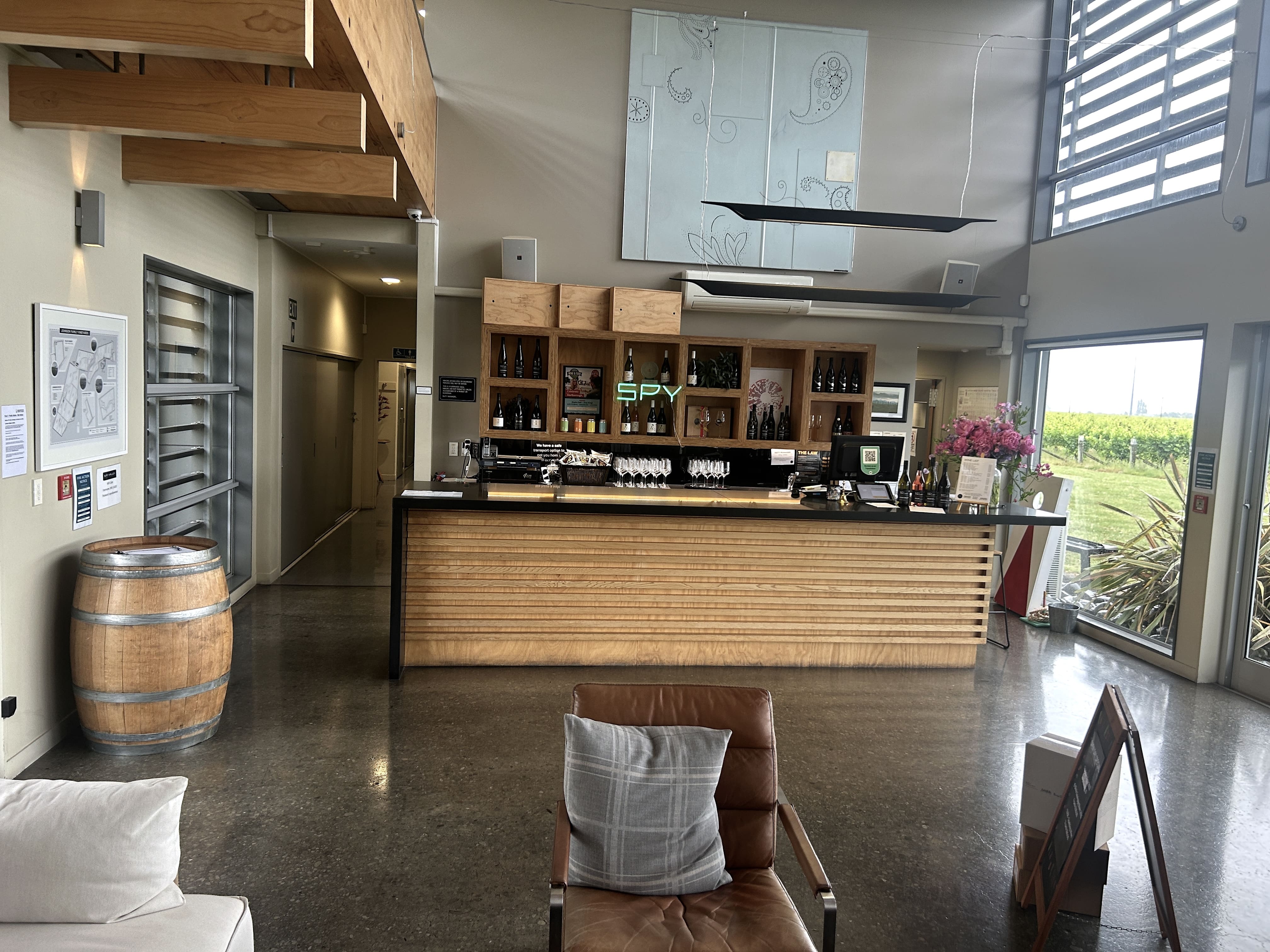
 It is very unusual to have a themed
winery, but that is the case with Spy Valley Winery. Build
near satellite dishes and an international communications
center, Spy Valley has incorporated Morse Code into its labels
and logo, and the cellar door features floor to wall movie
posters from the James Bond Series. Oh and yes, they
make award-winning wine, and are known in for
their Savignon Blanc. Below is their promotion video, followed
by a few photos of the cellar door.
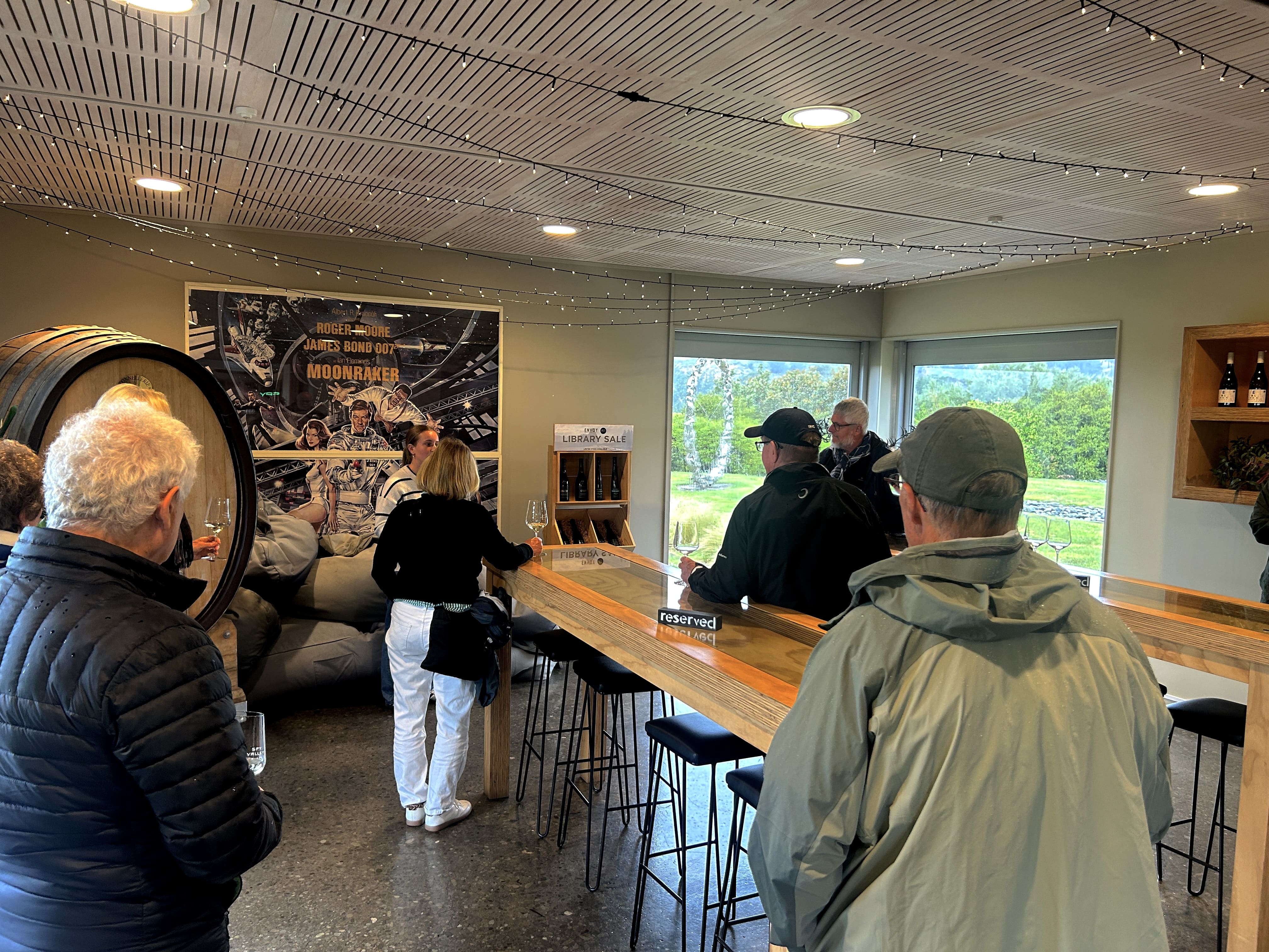
It is very unusual to have a themed
winery, but that is the case with Spy Valley Winery. Build
near satellite dishes and an international communications
center, Spy Valley has incorporated Morse Code into its labels
and logo, and the cellar door features floor to wall movie
posters from the James Bond Series. Oh and yes, they
make award-winning wine, and are known in for
their Savignon Blanc. Below is their promotion video, followed
by a few photos of the cellar door.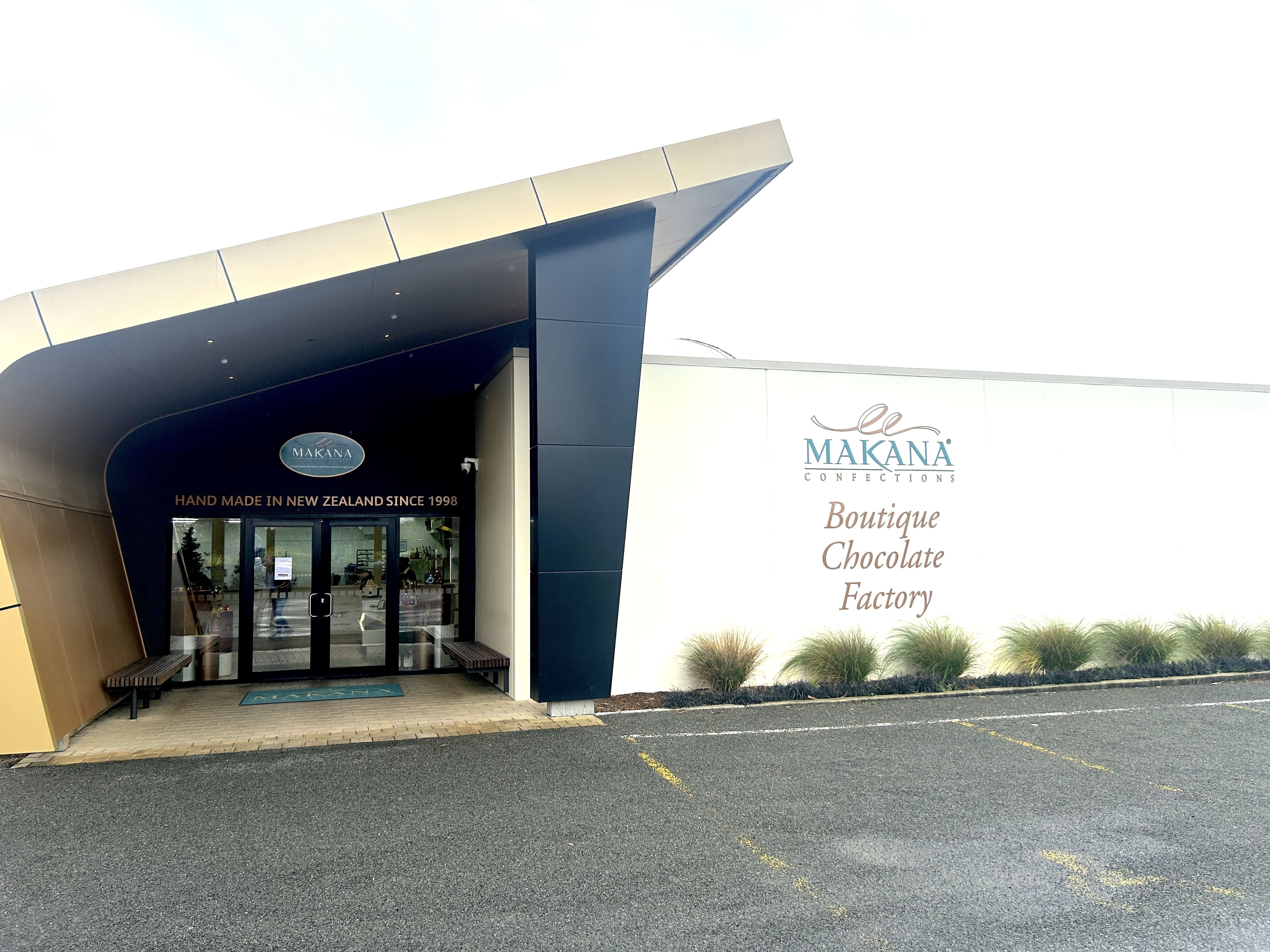
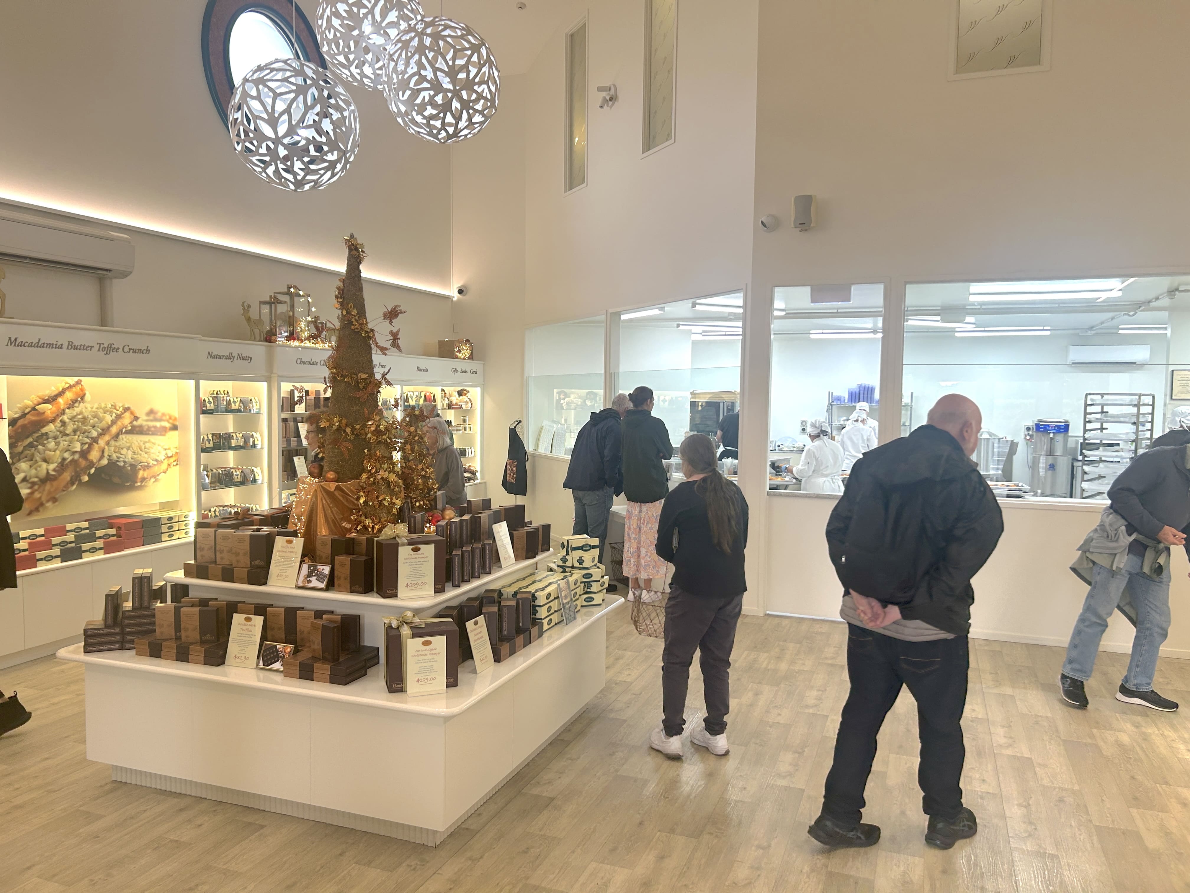 What is the perfect way to end a day of
wine tasting? Well, to top it off with a visit to a chocolate
factory, of course! The Makan Confections is a boutique
chocolate factory and a showroom. Famous for their macadamia
confections, they produce a wide variety of chocolate treats, as
detailed in their promo video below. The factory itself is
visible from the showroom, so guests can watch how these sweet
treats are made. Wine and chocolate--a day well spent!
What is the perfect way to end a day of
wine tasting? Well, to top it off with a visit to a chocolate
factory, of course! The Makan Confections is a boutique
chocolate factory and a showroom. Famous for their macadamia
confections, they produce a wide variety of chocolate treats, as
detailed in their promo video below. The factory itself is
visible from the showroom, so guests can watch how these sweet
treats are made. Wine and chocolate--a day well spent!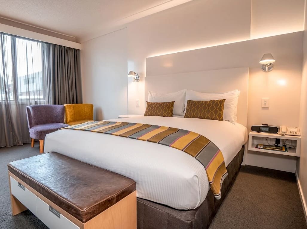 After our epic epicurean
day, we arrived at our new abode, the Scenic Marlborough
hotel, a beautiful hotel set in the heart of Marlborough
wine country. We ate at the restaurant, giving us time to
catch up on our laundry, as well as our sleep. Very
excited--tomorrow we are going to the Omaka Heritage
Aviation Museum!
After our epic epicurean
day, we arrived at our new abode, the Scenic Marlborough
hotel, a beautiful hotel set in the heart of Marlborough
wine country. We ate at the restaurant, giving us time to
catch up on our laundry, as well as our sleep. Very
excited--tomorrow we are going to the Omaka Heritage
Aviation Museum!
![]()
